
HIGH-QUALITY
GEOSPATIAL DATA FOR PERFECT AI MODELS
Annotating data is a precise method that involves labeling different features or objects in geographical data, such as aerial images, LiDAR data, GIS datasets, and satellite imaging. These annotations include a wide range of information, from identifying vegetation, water bodies, and other essential aspects of the imagery to locating buildings and roadways. Our profes...
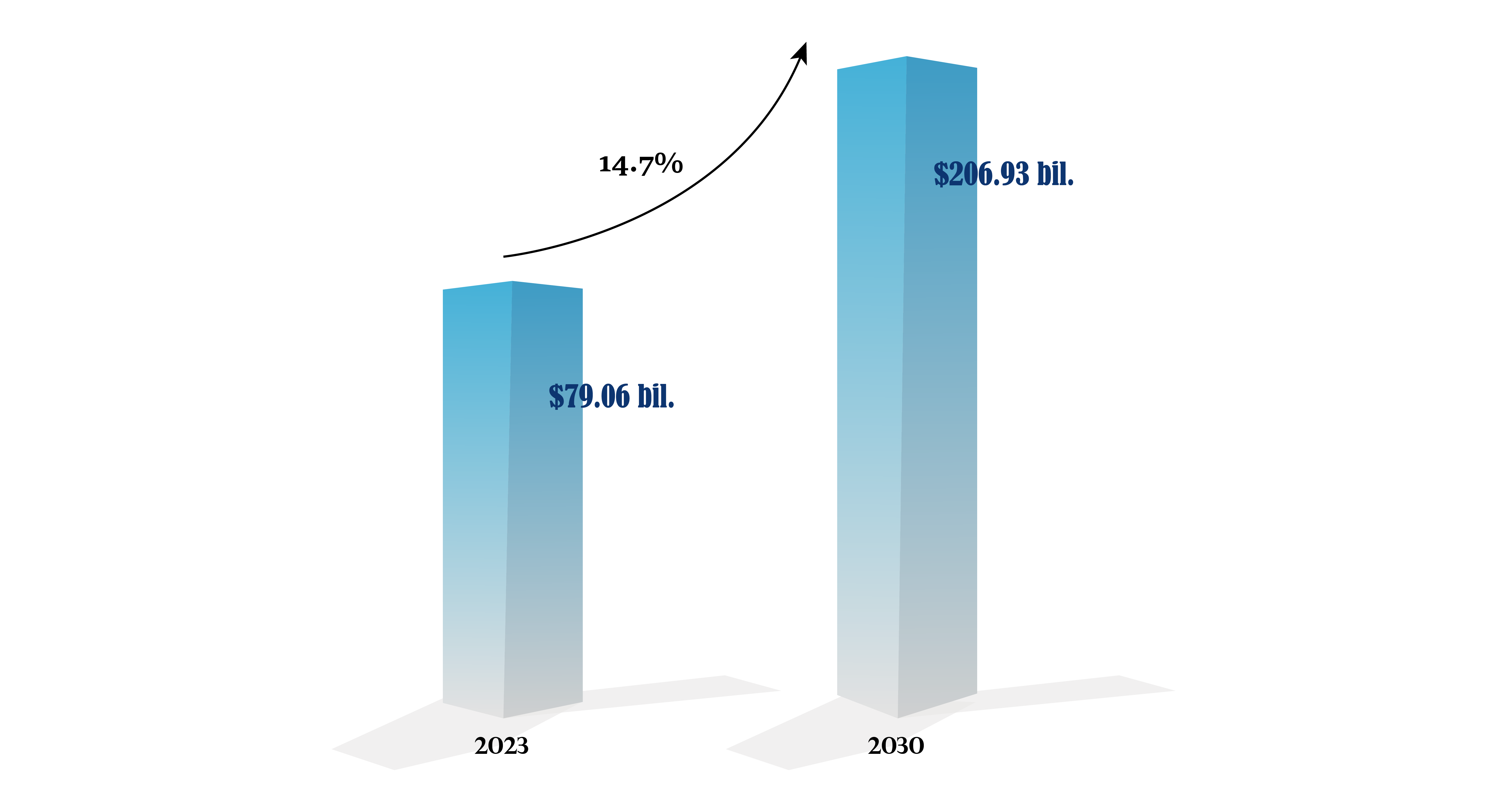
The global geospatial analytics market size is projected to grow from $79.06 billion in 2023 to $206.93 billion by 2030, at a CAGR of 14.7% during the forecast period.
USE CASES IN GEOSPATIAL AI
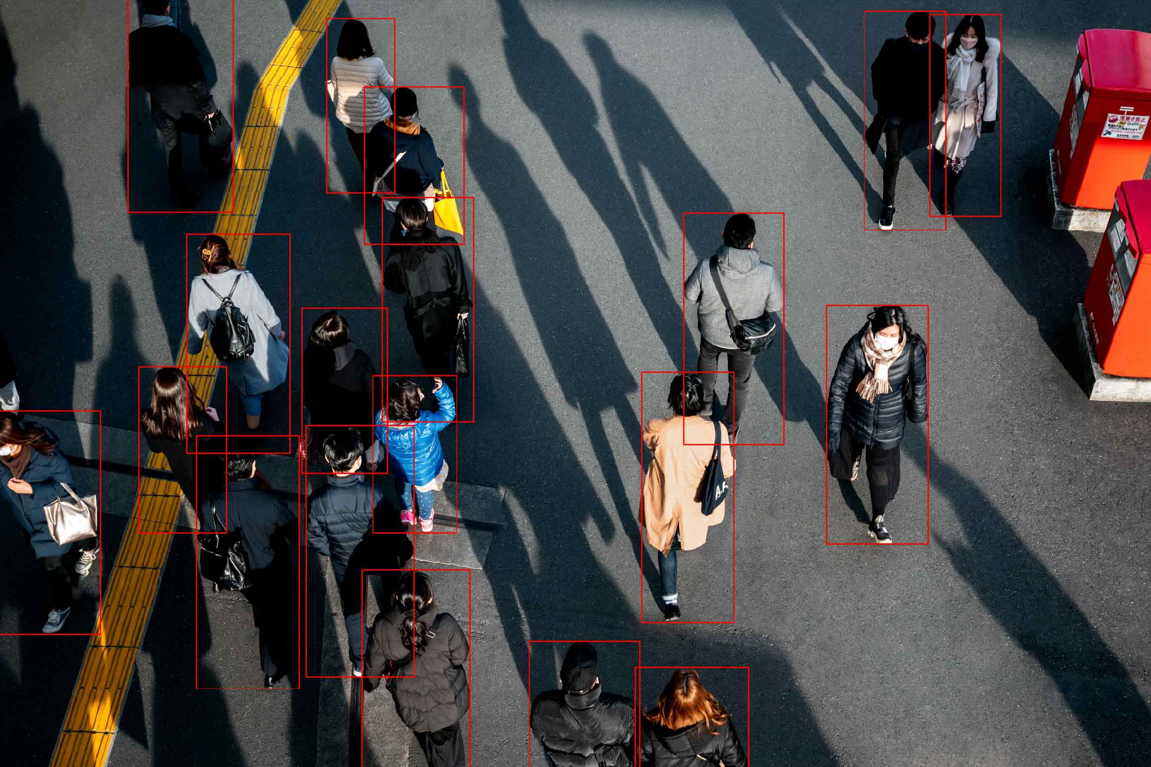
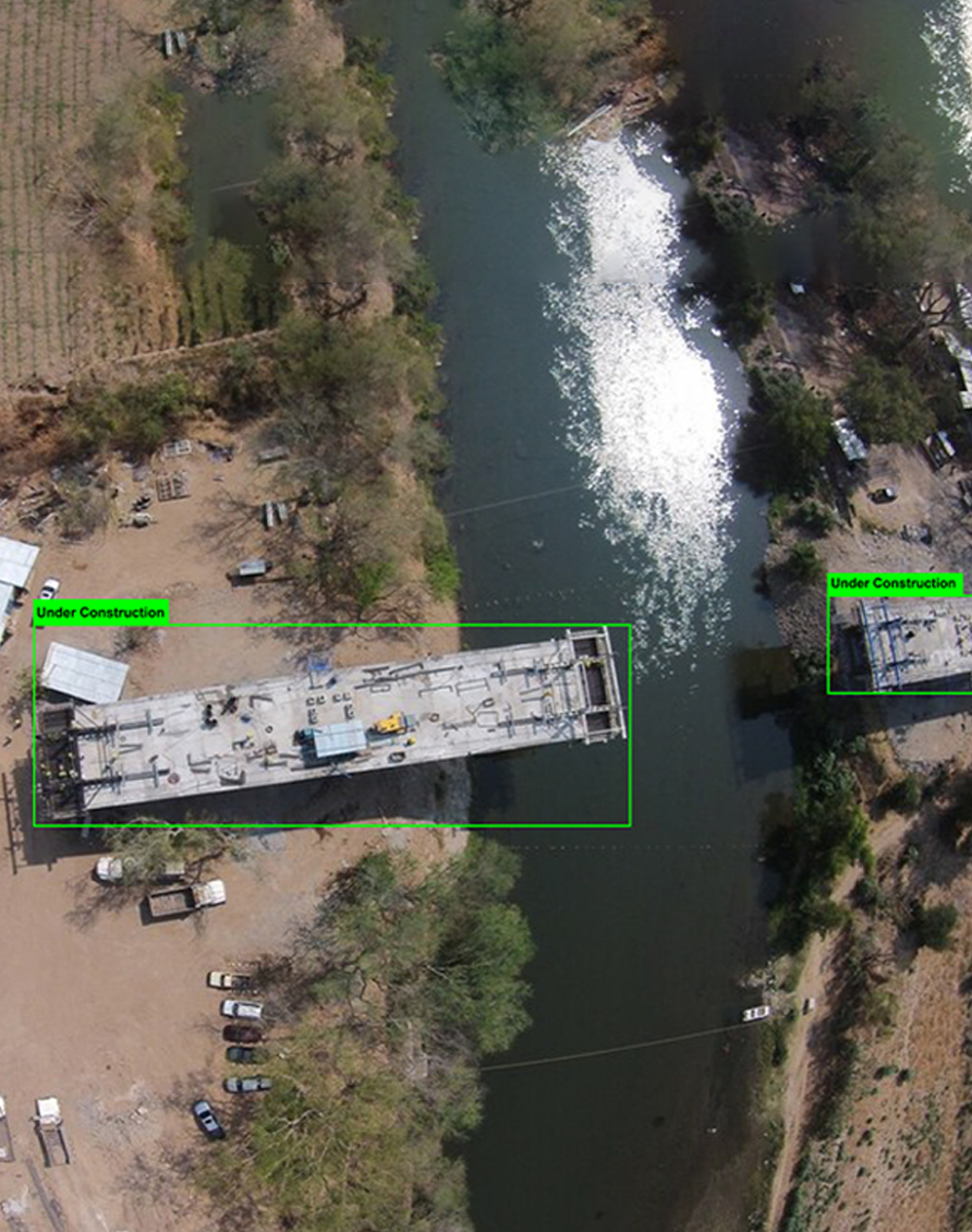
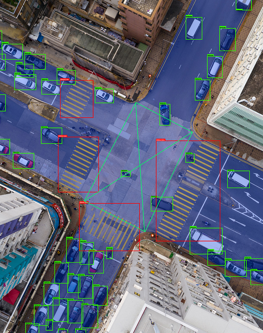
Annotating geospatial AI data is critical for object detection tasks such as identifying specific structures, vehicles, or natural features within images. Annotated geospatial data, including GIS-based inputs, serves as the foundation for training machine learning and artificial intelligence models. Annotations that accurately enable AI models to recognize these aeria...
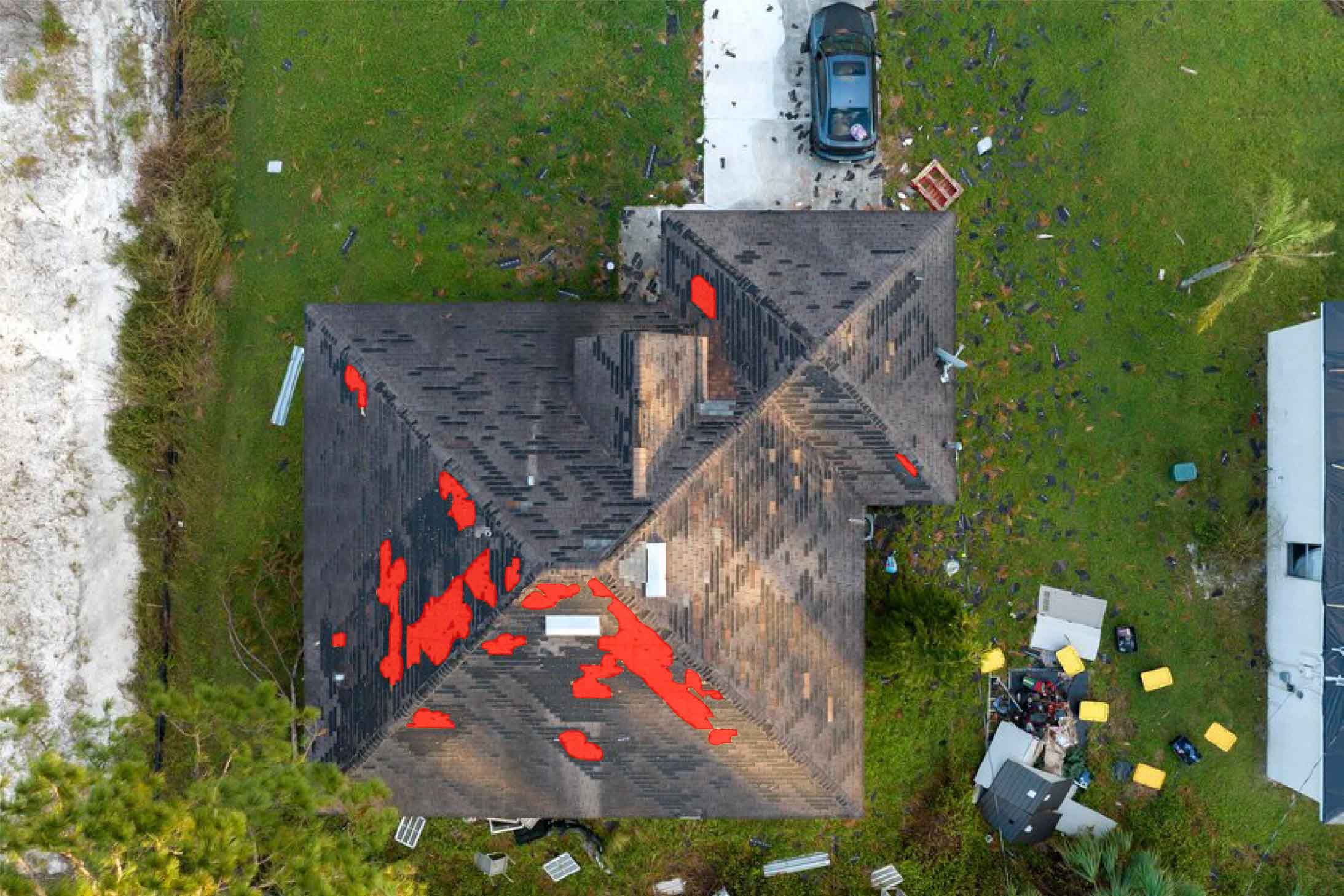


Roof Damage Detection
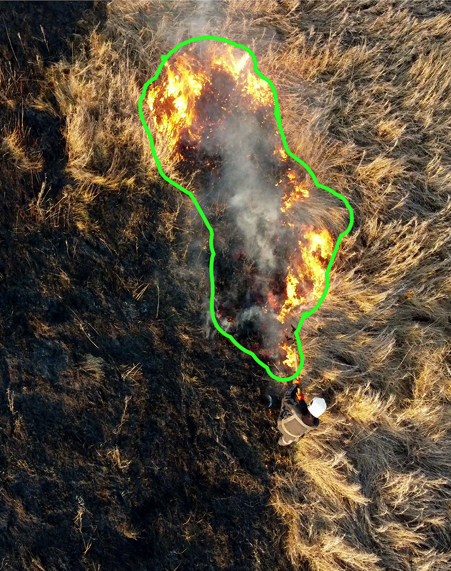
AI technological advancements play a crucial role in disaster response and recovery efforts, enabling rapid assessment of affected areas. Precise and thorough training of data is critical for AI model...
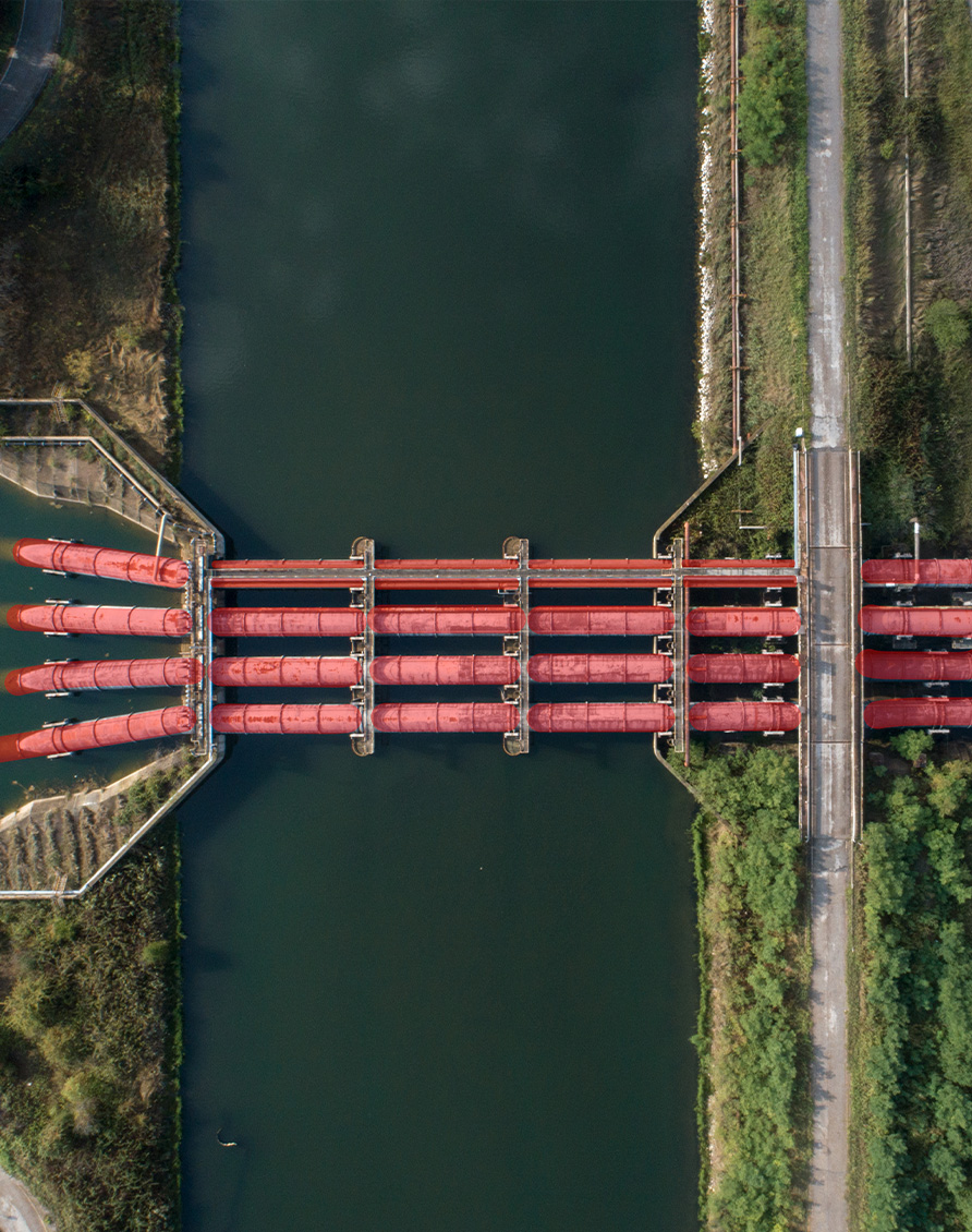
Segmentation for GeoSensing
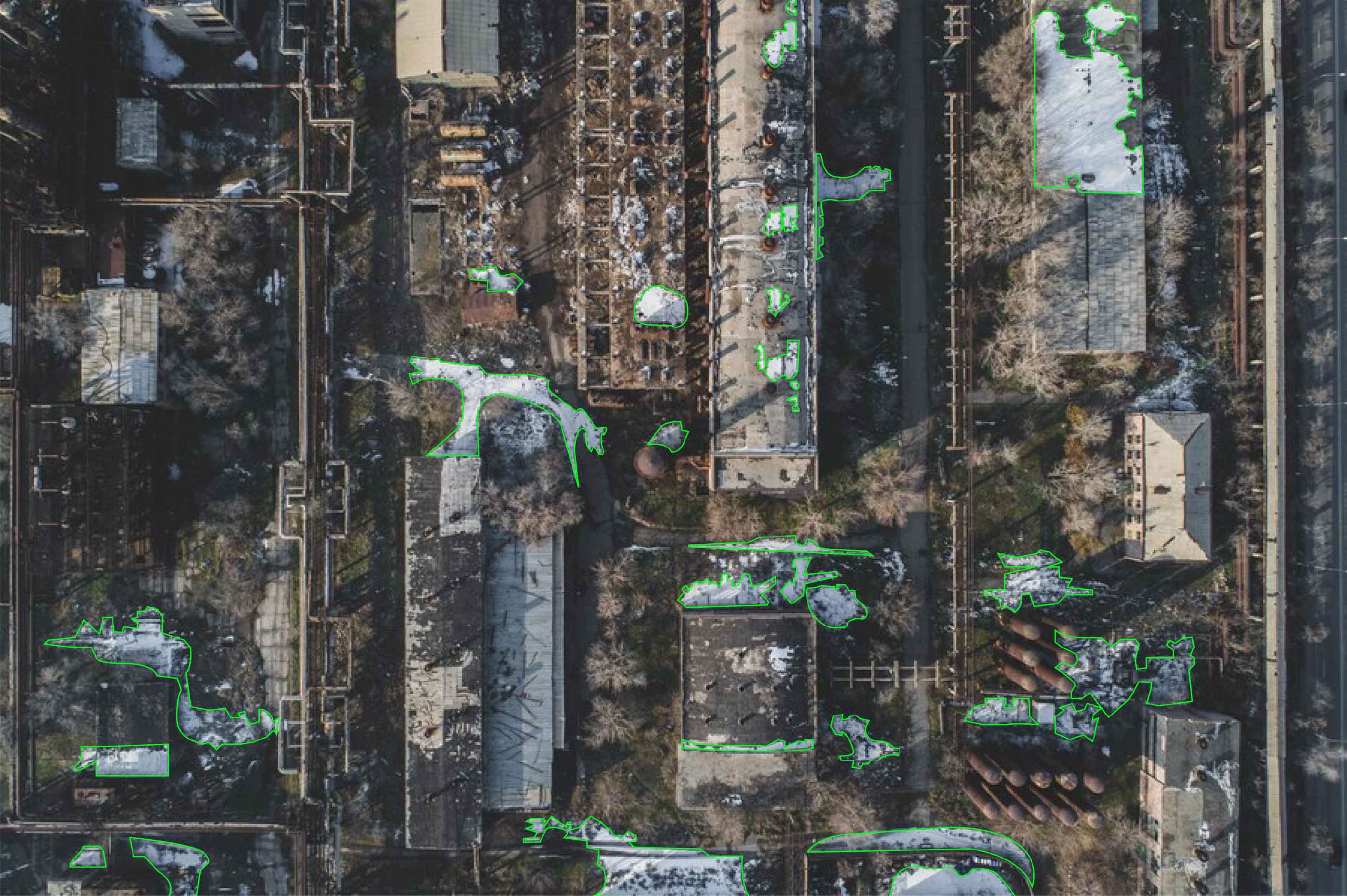
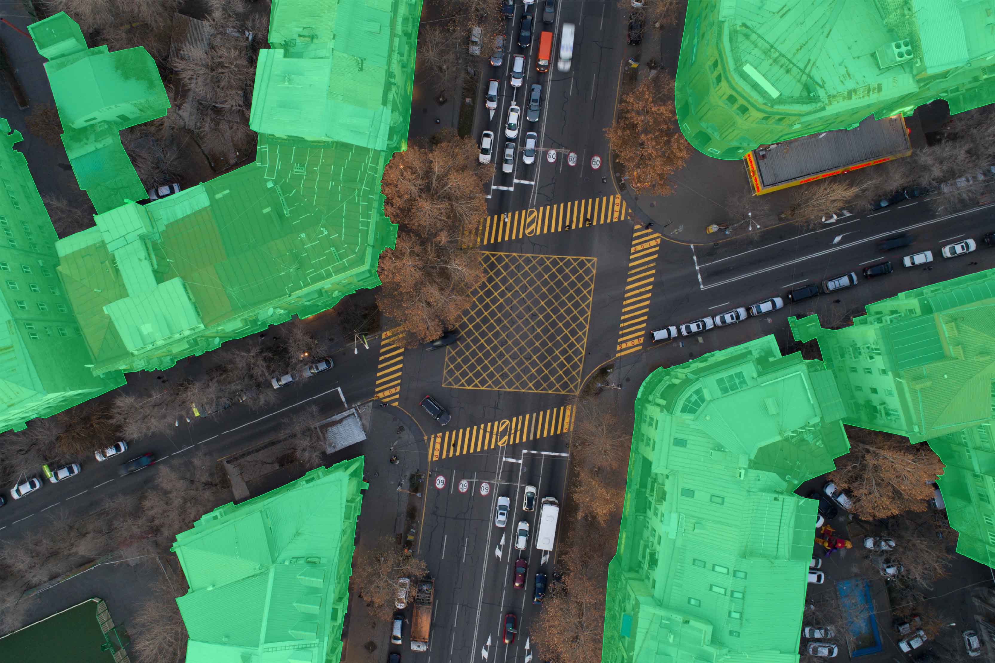
Within the geospatial industry, AI-powered geosensing segmentation is taking leading roles in the area of innovation, and data annotation is emerging as the key to its success. We are experts in annot...


HOW INFOLKS SPECIAL?
Specialised Team of Annotators
Industry Experience
Quality Assurance
Timely Delivery
Specialised Team of Annotators
We have a specialised team of annotators for different areas from medical to automotive, ensuring expertise in specific sectors.
Industry Experience
Our industry experience allows us to provide accurate annotations tailored to specific industry needs.
Quality Assurance
Each annotated output undergoes a rigorous triple-level quality check to ensure high standards are maintained.
Timely Delivery
We pride ourselves on delivering annotated data within specified timelines, ensuring that our clients' projects progress smoothly.
