
Get all your annotation requirements done for just $3.5/hr.
Try our
free demo services Now
Aerial imagery annotation is required when the computer vision model need training data of aerial images. It is the labeling of images captured from drones and other related sources using various kinds of annotation techniques
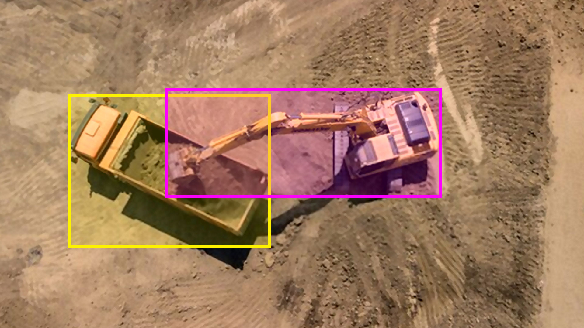
Inspections are now characterised by drones, especially in industries. We label people, objects and other field equipment in aerial images captured by drones using various annotation techniques.
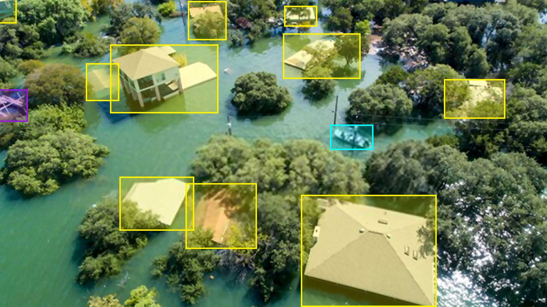
We analyse pre and post aerial images of disaster-hit locations and label structures like buildings, ports, utility sheds, etc. for enabling smart and effective disaster management projects.
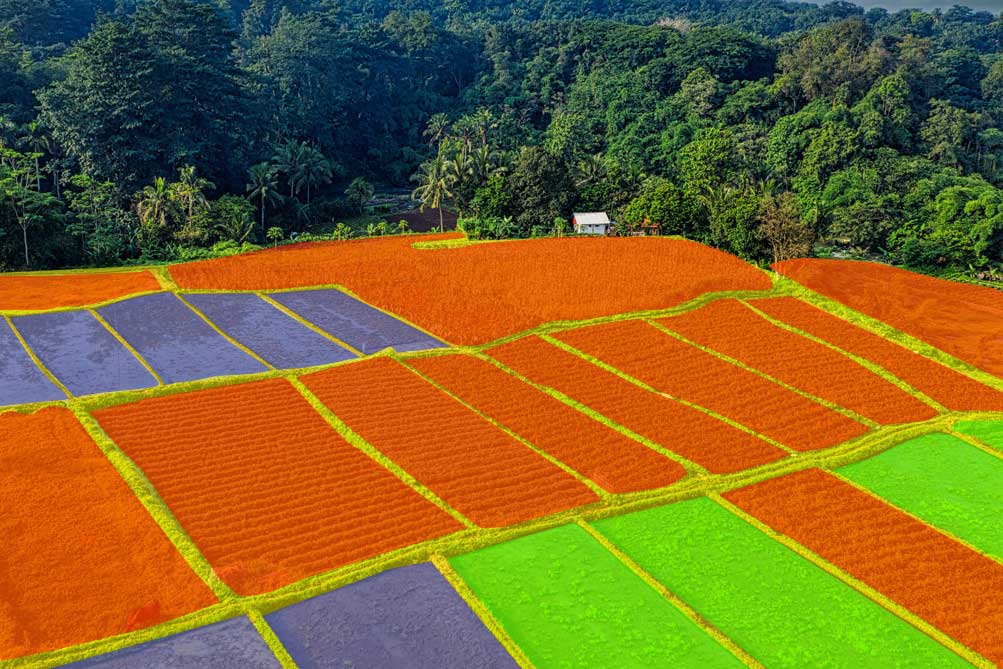
We analyse aerial images of agricultural fields captured by drones and label them using semantic segmentation technique.
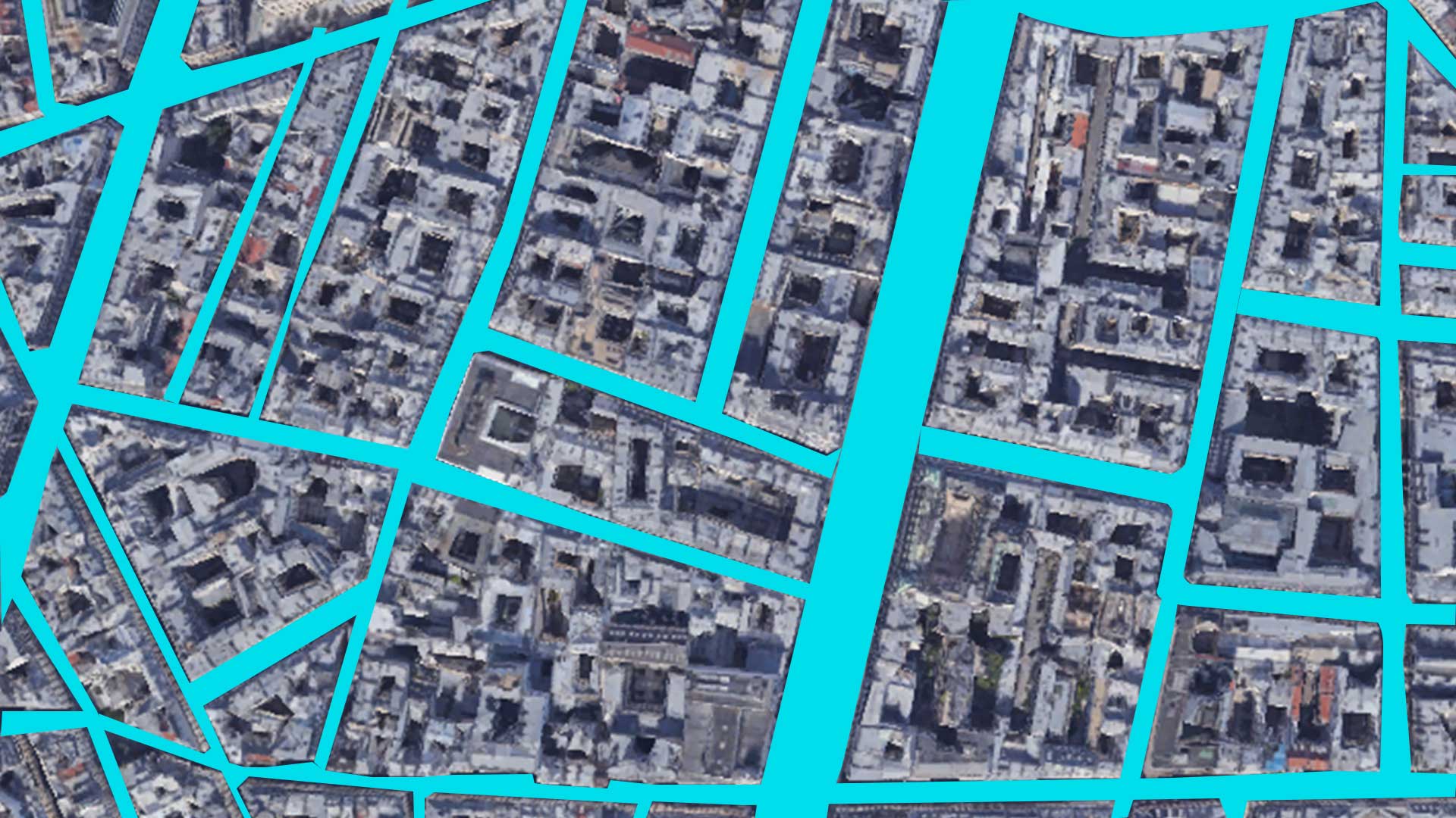
With our annotation services, you can analyse and label spatial data like satellite images and visual GPS data. We label clusters of buildings, fields, forests, etc.
ISO 27001:2013 Certified | ISO 9001:2015 | © 2025 INFOLKS